GARMIN GMR 436 xHD3 radar, 72", open array, 72 mile
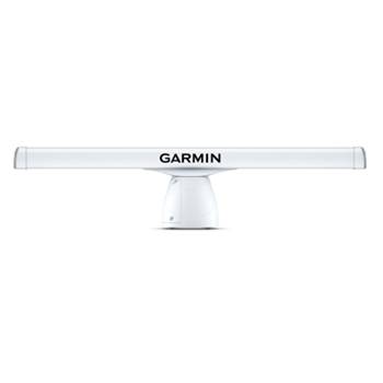
GARMIN GMR 436 xHD3 radar, 72", open array, 72 mile
Part #: K10-00012-25
SCAN WITH THE MAGNETRON POWER OF GARMIN OPEN-ARRAY RADAR
Combining high-definition imaging with the latest Garmin platform technology, these robust 4’ and 6’ open-array radars offer superior weather, obstacle and traffic detection for mariners cruising or fishing offshore.
4-, 12- OR 25kW OUTPUT, UP TO 96-NAUTICAL MILE RANGE
SCAN AVERAGING TECHNOLOGY
IMPROVED TARGET-SIZE PROCESSING
SPLIT-SCREEN DUAL-RANGE DISPLAY
100-KNOT COMMERCIAL GRADE WIND RATING1
QUIET OPEN-ARRAY DRIVE
SCAN WITH THE MAGNETRON POWER OF GARMIN OPEN-ARRAY RADAR
Combining high-definition imaging with the latest Garmin platform technology, these robust 4’ and 6’ open-array radars offer superior weather, obstacle and traffic detection for mariners cruising or fishing offshore.
![]()
4-, 12- OR 25kW OUTPUT, UP TO 96-NAUTICAL MILE RANGE
![]()
SCAN AVERAGING TECHNOLOGY
![]()
IMPROVED TARGET-SIZE PROCESSING
![]()
SPLIT-SCREEN DUAL-RANGE DISPLAY
![]()
100-KNOT COMMERCIAL GRADE WIND RATING1
![]()
QUIET OPEN-ARRAY DRIVE MOTOR
TOP FEATURES
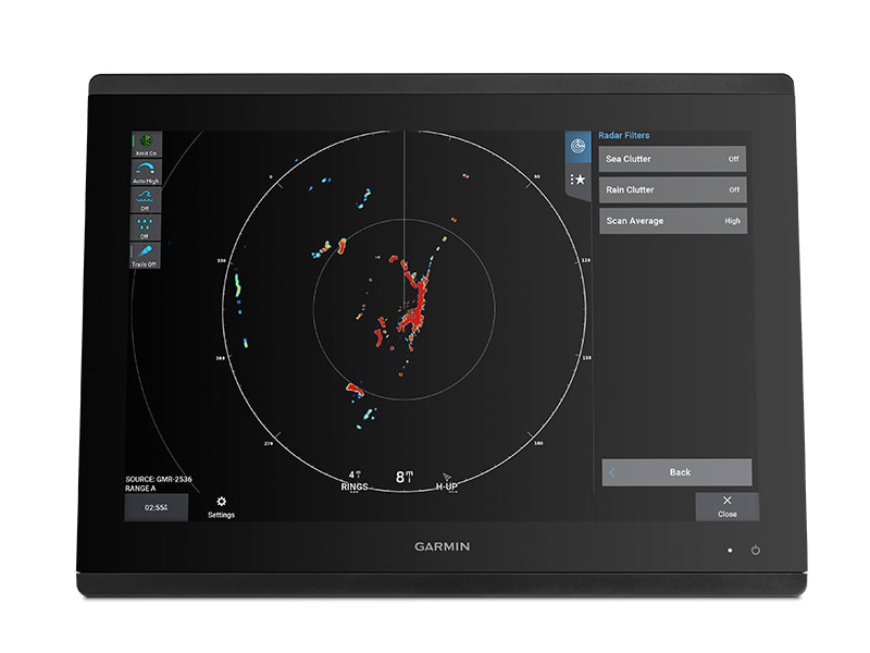
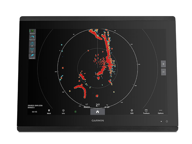
NEW SCAN AVERAGING TECHNOLOGY
A first for Garmin magnetron radar, scan averaging helps filter out sea clutter and interference to enhance the detection and display of consistent targets.
ANGULAR TARGET-SIZE ADJUSTMENT
Pulse expansion and angular target-size processing techniques optimize on-screen object shapes for better interpretation at all range scales.
HIGH-PERFORMANCE ANTENNAS
The 100-knot wind-rated open-array antennas1 have rotation speeds of 24 and 48 RPM for fast redraw rates, with max range up to 96 nautical miles on the 25-kW versions (up to 72 nautical miles on the 4- and 12-kW versions).
TRUE ECHO TRAILS
A historical “trail” of boats on the water is displayed on the screen, removing relative motion influence to help you quickly identify moving targets and potential collision threats.
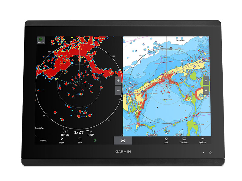
DUAL RANGE WITH OVERLAY
A single radar antenna is capable of providing split-screen, side-by-side images on your compatible chartplotter, with independent range setting and controls for both close and long range. Overlay either or both ranges on a chart.
DYNAMIC AUTO GAIN
Gain automatically adjusts levels to optimum settings for harbors, near shore and offshore in open waters.
VIEW TARGETS WITH SUPERIOR CLARITY AND DETAIL
![]()
RADAR OVERLAY
See overlaid images on your chartplotter’s map screen (with appropriate sensors, sold separately).
![]()
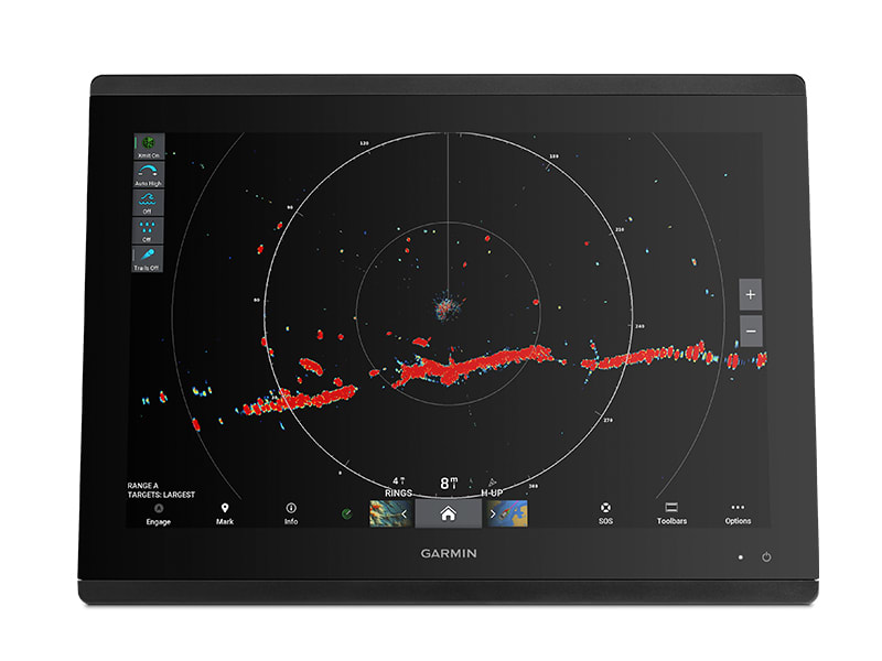
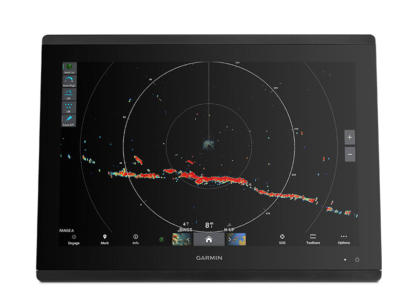
HIGH-RESOLUTION RADAR
Pick out targets at a distance, thanks to narrow horizontal beamwidth and high antenna gain.
![]()
DUAL-RADAR SUPPORT
This provides redundancy and allows each display unit to pull data from different sources.
![]()
DYNAMIC SEA FILTER
Radar gain automatically adjusts sea clutter for calm, medium and rough sea conditions.
![]()
AUTO BIRD GAIN
Locate flocks of birds at the water’s surface where baitfish are also likely to be found.
![]()
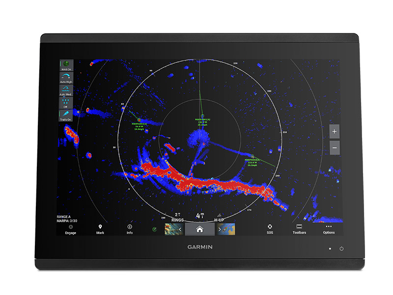
MARPA TARGET TRACKING
Track up to 30 targets to help avoid collisions (with appropriate sensors, sold separately).
![]()
GUARD ZONE
Set the safety zone, and receive an alarm when an object enters the zone.
![]()
RANGE AND BEARING CUES
Variable range markers and electronic bearing lines allow rapid measurements of distance and bearing to vessels and land.
Manufacturer: Garmin
Part #: K10-00012-25
Width: 76.50 in.
Height: 17.70 in.
Weight: 65.20 lbs.
Antenna Size: 72 in
Type: Open Array
Color: White
Wireless: No
Transmit Power: 4,000 Watts
Max Range: 72 nm
Doppler Collision Avoidance: No
Bird Mode: Yes
MARPA Target Tracking: Yes
Beam Width H: 1.10
Beam Width V: 23
Cable Length: 15 m
Supply Voltage: 11-35 Volts
Power Consumption (Standby): 18 Watts
Power Consumption (Max): 55 Watts
- Ships in 3 - 4 Weeks

 $391.99
 $272.57